The #30DayMapChallenge starts tomorrow. Every November, people around the world make one map a day for 30 days, each based on a different theme. This year I am taking part with a twist. Every map I make this November will be made with MapAI.
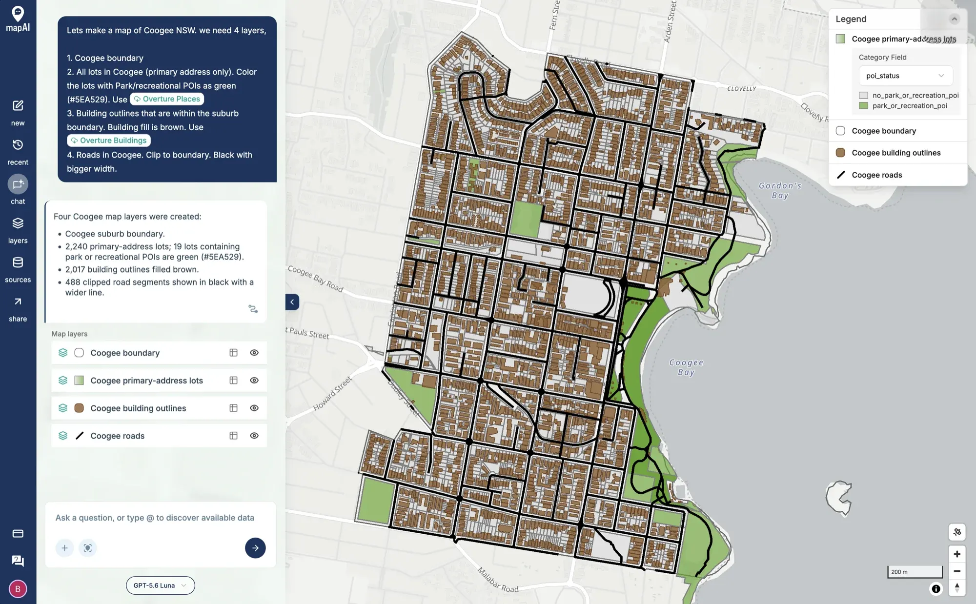 A warm-up map of Coogee made in MapAI: four layers from one prompt, using Overture Places and Overture Buildings.
What is MapAI?
MapAI is a spatial analysis platform that lets you ask a place-based question in plain English and get back a trusted, evidence-backed answer. The tagline on the website sums it up: trusted spatial answers, assembled instantly.
Anyone who has worked in planning, property, infrastructure or policy knows the drill. You have a simple sounding question like “Which schools are within bushfire-prone land in this LGA?” or “How much residential land is zoned within 800 metres of these stations?”. Answering it means finding the right datasets, checking how current they are, wrangling them into the same format, running the analysis in a GIS and then explaining to someone else how you got there. That can take days, and usually needs a GIS specialist.
MapAI does that legwork for you. It finds, combines and checks the spatial datasets, runs the analysis on a PostGIS engine (buffers, intersections, spatial joins, proximity, demographic cross-tabs) and gives you a map with the answer. More importantly, it shows its working. Every result comes with an evidence trail covering the sources, the assumptions, the limitations and the steps behind it. Experts can validate a method and others can reuse it as a workflow. And the final call always stays with a person, or as we put it, human judgement stays human.
A few other things I am proud of:
- It sits alongside the tools people already use, like ArcGIS, QGIS and spatial databases, rather than trying to replace them.
- You can bring your own data (.shp, .gdb, .gpkg, GeoJSON, KML, CSV), connect to public ArcGIS REST services and export maps, CSV and GeoJSON.
- It is hosted in Australia and customer data is never used to train public models.
- It is free to start, with a monthly allowance of free credits and unlimited users on every plan.
Two years in the making
I have been working on MapAI for the past two years. It started as research at UNSW’s City Futures Research Centre and grew into a UNSW spinout. Along the way it has been tested with teams across state government, local government and the private sector, and it has become the spatial reasoning engine behind other projects too. Two years of late nights, rewrites and countless “why is this polygon invalid” moments later, I am very happy to say that MapAI is alive and launched. The public release is open now, and MapAI Explore is available in Australia. You can sign up and try it for free at mapai.net.
Why do the challenge with MapAI?
Building a product is one thing; using it every single day under pressure is another. The challenge is the perfect stress test. Thirty themes, from classics like points, lines and polygons to odd ones like Borgesian map, Inside out and NULL. Some of them will be right in MapAI’s comfort zone, and some of them (looking at you, Pen & paper and Senses: Smell) will stretch it, and me, quite a bit. I want to find out where it shines, where it struggles and what we need to build next.
I also want to be open about how each map is made. The challenge asks participants to be transparent about the AI tools they use, and that happens to be what MapAI is designed for. For every map, I will share the question I asked, the data it used and the steps it took, so you can judge the result for yourself. Where I tweak or style things by hand, I will say so.
So this year is all about MapAI. I will post each map here on the blog and on social media with the hashtags #30DayMapChallenge, #mapai and #madewithmapai. If you decide to try MapAI for your own maps this November, use #madewithmapai too. I would love to see what you make with it.
See you tomorrow for Day 1: Points!